
Topographical Surveys in Crawley & Gatwick
Topographical and land surveys across Crawley, Manor Royal and the Gatwick area for architects, engineers, developers and contractors, a short drive from our Horsham head office.
Call Us For A Free Quote 0345 548 5451- Head office in Horsham, West Sussex
- OS National Grid & Ordnance Datum
- DWG, DXF, PDF & 3D models
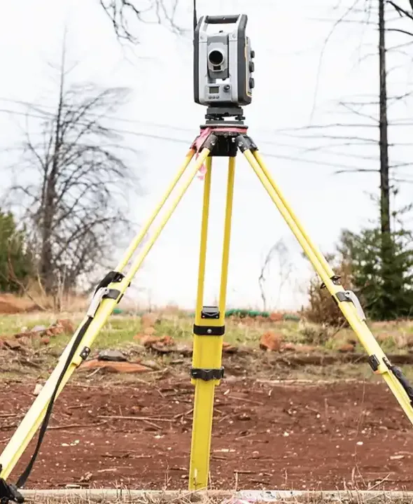
Land and site surveys in Crawley & Gatwick for design and planning
Ambler Group carries out topographical surveys in Crawley & Gatwick for architects, engineers, developers, housebuilders and contractors. Crawley and Gatwick are a short drive along the A264 from our Horsham head office, so we can be on site quickly across the town, Manor Royal and the airport area. We capture levels, features and boundaries with robotic total stations and GNSS, and deliver CAD drawings ready for design, planning and setting out.
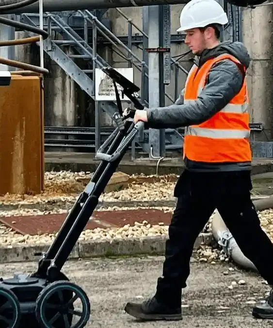
Need what is below ground too? We also carry out PAS128 utility and GPR surveys in Crawley & Gatwick and CCTV drainage surveys. Find out more about our topographical surveys and utility surveys across the UK on the main Ambler Group website.
Contact usTopographical surveys on Crawley & Gatwick sites
Crawley’s neighbourhoods and business parks look flat, but the land falls north towards the River Mole and Gatwick Stream and rises towards Tilgate and Pease Pottage in the south. Those subtle falls matter for drainage, finished floor levels and level access, and sites close to the airport also need building and crane heights checked against aerodrome safeguarding.
We survey levels, contours, buildings, kerbs, trees and covers, with building heights to Ordnance Datum where planning or safeguarding needs them. Typical Crawley instructions include unit extensions and yard regrading on Manor Royal, residential infill in the town’s neighbourhoods, hotel and car park schemes near Gatwick and highway works on the edges of the town.
Typical Crawley & Gatwick topographical survey instructions
- Topographical survey of a Manor Royal unit and yard for an extension and new drainage
- Levels survey of a hotel car park near Gatwick for resurfacing and EV charging
- Site survey of a neighbourhood garage court for a small housing scheme
- Roof and ground levels to Ordnance Datum for an aerodrome safeguarding check
Topographical and land survey services in Crawley & Gatwick
People search for this work in different ways – a topographical survey, a topo survey, a land survey, a site survey, a levels survey or a measured survey. In Crawley & Gatwick they usually mean one of the services below, and we provide all of them.
Topographical surveys in Crawley & Gatwick
Levels, contours and features in CAD on OS National Grid and Ordnance Datum, for design and planning.
Find out moreSurveys for planning applications in Crawley & Gatwick
Existing site drawings, neighbouring heights and street elevations for planning and Building Regulations.
Find out moreMeasured building surveys in Crawley & Gatwick
Floor plans, sections and elevations of existing buildings for refurbishment and alteration.
Find out more3D laser scanning in Crawley & Gatwick
High-density point clouds and 3D models of buildings, structures and complex sites.
Find out moreTopographical + utility surveys in Crawley & Gatwick
Buried services and drainage added to the same drawing, from one team on one visit.
Find out moreSetting out & volume surveys in Crawley & Gatwick
Setting out from the same survey control, and earthworks volumes from 3D ground models.
Find out moreWhat we plan for on Crawley & Gatwick topographical surveys
Aerodrome safeguarding
Building and crane heights near Gatwick are checked against safeguarding limits, so we deliver roof and ground levels to Ordnance Datum.
Flood risk
Low ground along the River Mole and Gatwick Stream needs accurate levels for flood risk assessments and floor levels.
Large yards
Industrial yards and car parks need dense levels and falls so new drainage and resurfacing work first time.
Neighbourhood infill
Garage courts and corner plots sit tight against houses, so boundaries, windows and heights are picked up for neighbours.
Topographical surveys for development projects in Crawley & Gatwick
Architects, engineers, developers, housebuilders and contractors use our topographical surveys at every stage of a project in Crawley & Gatwick – from deciding whether to buy a site to setting out the finished scheme.
Feasibility and purchase
An early topographical survey shows what a site can take before you buy or commit to a design.
Planning and Building Regulations
Accurate levels, boundaries, trees and neighbouring heights for planning drawings, flood risk assessments and Building Regulations packages.
Detailed design
A 3D surface and full detail for engineers designing roads, drainage, earthworks and foundations.
Setting out and as-built
Control left on site for setting out, and as-built surveys at the end of the job for handover.
What your topographical survey includes
- Spot levels and contours across the site, to Ordnance Datum
- Buildings, walls, fences, kerbs, paths, hardstanding and road markings
- Trees with trunk diameter, canopy spread and height
- Manhole and gully covers with cover levels (invert levels on request)
- Overhead lines, poles, lighting columns and street furniture
- Building heights, eaves, ridges and street elevations where needed
- CAD drawings (DWG/DXF) on OS National Grid, with PDF plots
- 3D surface or model for earthworks and design on request
We survey with robotic total stations and Emlid Reach RS3 GNSS receivers, with 3D laser scanning available for complex buildings and structures.
How it works
- 1
Send us the site
Email a site plan or marked-up aerial showing the boundary of the survey, and what the survey is for.
- 2
Fixed quote and RAMS
We confirm the level of detail, extras such as building heights, days on site and the drawing format.
- 3
Survey on site
Our surveyors attend from our Horsham head office, a short drive from Crawley, bringing robotic total stations and GNSS.
- 4
Drawings delivered
You receive DWG, DXF and PDF drawings, tied to OS National Grid and Ordnance Datum, ready for design.
Topographical Surveys in Crawley & Gatwick | Frequently Asked Questions
Q1: How quickly can you carry out a topographical survey in Crawley?
A: Crawley is a short drive from our Horsham head office, so most sites can be surveyed soon after the scope is agreed. Send a site plan or marked-up aerial with your deadline and we will confirm a date with the quote.
Q2: Can you provide heights to Ordnance Datum for Gatwick safeguarding?
A: Yes. We survey ground levels, roof and parapet heights and rooftop plant to Ordnance Datum Newlyn, so your architect or consultant can check the scheme and crane heights against the airport’s safeguarding requirements.
Q3: Do you survey for flood risk assessments in Crawley?
A: Yes. We survey site and threshold levels to Ordnance Datum, along with nearby watercourse banks and beds where needed, for your flood risk consultant and engineer.
Q4: What does a topographical survey include?
A: A topographical survey records the levels and features of a site: spot heights and contours, buildings, walls, fences, kerbs, paths, trees, covers, street furniture and overhead lines. We can add building heights, street elevations, floor levels and a 3D surface where the design needs them.
Q5: What coordinate system will the survey be in?
A: Our surveys are tied to OS National Grid and levelled to Ordnance Datum Newlyn using GNSS, so they line up with OS mapping, other surveys and your design. We can also work to a local site grid if your project uses one.
Need a service & ready to book? Call us 0345 548 5451
Email usWhy choose Ambler Group for topographical surveys in Crawley & Gatwick?
Head office in Horsham
Our head office is in Horsham, West Sussex, so your site in Crawley & Gatwick is covered by our southern survey teams – a local firm that knows the area.
Surface and below ground
Because we are utility surveyors too, your topographical survey can include buried services and drainage on the same drawing.
Everything in one visit
PAS128 utility, GPR, topographical and CCTV drainage surveys from one team, with one set of RAMS and one coordinated set of drawings.
If you’re looking for reliable, professional topographical surveys in Crawley & Gatwick, contact us today!
Other surveys we provide in Crawley & Gatwick
Ambler Group is a full surveying company. Book your topographical survey alongside any of these and get one team, one set of RAMS and one coordinated set of drawings.
PAS128 Utility & GPR Surveys in Crawley & Gatwick
Locating and mapping buried services with EML and GPR to PAS128 quality levels before you dig.
Find out moreCCTV Drainage Surveys
Commercial and construction CCTV drainage surveys, drain mapping and graded defect reports.
Find out moreGPR Surveys & Concrete Scanning
Ground-penetrating radar for non-metallic services, voids, and concrete scanning (ferroscanning) of slabs and structures.
Find out moreDesktop Utility Searches
Statutory record (STATs) searches from asset owners, compiled into a single pack before site works or design.
Find out moreBorehole Clearance
Service clearance of borehole and trial pit positions for site investigation contractors.
Find out moreUtility Surveys (UK-wide)
Our main utility survey service page, covering PAS128 utility surveys across the UK.
Find out moreClients Reviews
“Ambler Group have been our number one go to for all of our topographical, UGS & GPR Surveys.”
Ryan, Director – Topographical, Utility and GPR
Helpful survey guides
What Does a Topographical Survey Cost?
What drives the price of a topographical survey, which extras add time, and how to get a fast, fixed quote.
Read the guide GuideTopographical Surveys for Planning in Sussex & Surrey
When a planning application in Sussex or Surrey needs a topographical survey, and what it should show.
Read the guide GuidePAS128 Quality Levels Explained: QL-D to QL-A
What QL-D, QL-C, QL-B1 to B4 and QL-A mean on a utility drawing, and which one your project needs.
Read the guideTopographical Surveys near Crawley & Gatwick
Also covering the rest of West Sussex – see all areas.
Topographical survey Horsham
Topographical and land surveys across Horsham town and district, from our head office in Horsham itself.
View areaTopographical survey Reigate & Redhill
Topographical and land surveys across Reigate, Redhill, Horley and Merstham, a short drive north of our Horsham head office.
View areaTopographical survey Haywards Heath & Burgess Hill
Topographical and land surveys across Haywards Heath, Burgess Hill and Mid Sussex, a short drive from our Horsham head office.
View areaContact Us
Book a survey in Sussex & Surrey
For a fast, fixed quote, send us:
- The site address or postcode
- A site plan or marked-up aerial image showing the survey area
- What the survey is for – design, planning, excavation, piling or records
- Access notes – working hours, permits, inductions
We usually come back with a fixed quote the same or next working day.
Head office:
Ambler Group Limited
Springfield House, Springfield Road,
Horsham RH12 2RGCompany registration number: 12568344
Areas we cover:
Horsham, Crawley and Gatwick, Haywards Heath and Burgess Hill, Worthing, Chichester, Guildford, Woking, Reigate and Redhill, Epsom and Leatherhead, Camberley and Farnham – and the rest of Sussex, Surrey and the South East.