
PAS128 Utility & GPR Surveys in Worthing
PAS128 utility surveys and GPR surveys across Worthing, Shoreham, Lancing and the Adur and Arun coast, from our head office in Horsham.
Call Us For A Free Quote 0345 548 5451- Head office in Horsham, West Sussex
- PAS128 quality levels QL-D to QL-A
- EML + GPR detection, CAD drawings
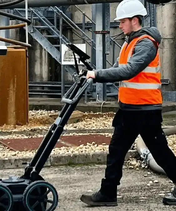
Underground utility surveys in Worthing – find it before you dig
Ambler Group carries out PAS128 utility surveys and GPR surveys in Worthing for main contractors, groundworkers, M&E contractors, developers, consultants and facilities teams. Worthing and the Adur and Arun coast are a straightforward drive down the A24 from our Horsham head office.
Need more than buried services? We also carry out topographical surveys in Worthing and CCTV drainage surveys. Find out more about our utility surveys and GPR surveys across the UK on the main Ambler Group website.
Contact usUtility surveys on Worthing sites
Worthing’s long seafront and Victorian and Edwardian streets sit on a narrow coastal strip between the sea and the South Downs. Services in the town centre are crowded under the footways and the promenade, the large residential areas built through the 20th century carry a patchwork of old and new mains, and the industrial estates at Lancing, Shoreham and East Worthing have private networks of their own.
Close to the sea, wet and salty ground can limit GPR, so we use EML and GPR together and inspect chambers to confirm what we find. Typical work includes seafront and public realm schemes, town-centre residential redevelopment, unit and yard works on the industrial estates, and highway works along the A27 and A259.
Typical Worthing utility survey instructions
- PAS128 survey of a seafront section ahead of public realm improvements
- GPR and EML survey of a town-centre site before piling for a residential block
- Utility mapping of a Lancing Business Park unit before a yard extension
- Concrete scanning of a car park deck before new drainage outlets
Utility and GPR survey services in Worthing
People search for this work in different ways – a PAS128 survey, a utility survey, a GPR survey, an underground service survey, a cable and pipe locating survey or a utility mapping survey. On construction and commercial sites in Worthing they usually mean one of the services below, and we provide all of them.
Desktop utility searches in Worthing
Records from the water, gas, electricity, telecoms and fibre operators compiled before site work (Survey Type D).
Find out morePAS128 detection surveys in Worthing
Services located with EML and GPR and drawn to PAS128 quality levels QL-B1 to QL-B4 (Survey Type B).
Find out moreGPR surveys in Worthing
Ground penetrating radar for plastic pipes, ducts, chambers, voids and old foundations that cable locators miss.
Find out moreUtility verification (QL-A) in Worthing
Services verified at chambers and exposed in trial holes at critical crossings and clash points.
Find out moreBorehole & trial pit clearance in Worthing
Service clearance of borehole, trial pit, piling and post positions before drilling or digging.
Find out moreConcrete scanning (ferroscanning) in Worthing
GPR scanning of slabs and walls for rebar, tendons and conduits before coring, drilling or cutting.
Find out moreWhat we plan for on Worthing utility surveys
Seafront and promenade
Services run under the promenade and seafront roads alongside outfalls and old structures, so we survey densely and verify at chambers.
Salty, wet ground
Near the sea, saline groundwater absorbs radar, so EML and chamber inspections carry more of the detection.
A27 corridor
Work on or beside the trunk road needs National Highways approvals and traffic management, which we plan into the programme.
Older housing areas
Older estates can have iron and lead services alongside newer plastic mains, which GPR helps to find.
Utility surveys for construction projects in Worthing
Main contractors, groundworkers, M&E contractors, developers and consultants use our utility surveys at every stage of a project in Worthing – from early design through to the moment the excavator arrives on site.
Design and feasibility
Desktop records and a detection survey early on show where services run and how deep they are, so the design avoids costly diversions.
Before you dig
A PAS128 survey with GPR, marked out on site, gives groundworkers a reliable picture before excavation, piling or ducting starts, in line with HSE guidance HSG47.
Borehole and trial pit clearance
Positions for site investigation, piling and fence posts checked and cleared before drilling or digging.
Records and handover
Utility drawings in CAD for the design team, the health and safety file and future works on the site.
What your utility survey includes
- Desktop utility records search from the asset owners (Type D)
- Site reconnaissance matching records to covers, markers and street furniture (Type C)
- Detection with electromagnetic location (EML) and ground penetrating radar (GPR) (Type B)
- Verification at chambers and exposed services where required (Type A)
- Every service labelled with its PAS128 quality level, including QL-B1 to QL-B4
- CAD drawings (DWG/DXF) tied to OS National Grid, with depths where detected
- Services marked out on site in paint or pegs on request
- Survey report setting out the methods used and any limitations
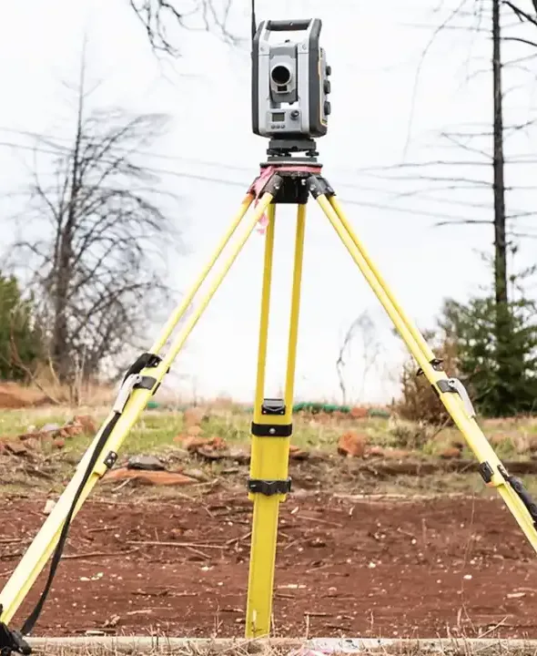
We locate services with Radiodetection RD8200 and RD8100 cable and pipe locators with signal transmitters, and Proceq GS8000 ground penetrating radar, positioned with GNSS and total stations on OS National Grid.
How it works
- 1
Send us the site
Email a site plan or marked-up aerial showing the area, plus what you need it for and any access notes.
- 2
Fixed quote and RAMS
We confirm the survey type, quality level and days on site, and issue site-specific RAMS for your induction.
- 3
Survey on site
Our surveyors attend from our Horsham head office, straight down the A24, set out any traffic management, and survey with EML and GPR.
- 4
Drawings and mark-out
You receive the CAD drawing and report, and services can be marked on the ground for your excavation team.
PAS128 Utility & GPR Surveys in Worthing | Frequently Asked Questions
Q1: How quickly can you carry out a utility survey in Worthing?
A: Worthing is a straightforward drive down the A24 from our Horsham head office, so most surveys can be booked in short order once scope and access are agreed. Tell us your deadline when you send the site plan and we will confirm a date with the quote.
Q2: Does GPR work close to the sea in Worthing?
A: Saline, wet ground absorbs radar and reduces GPR depth. We combine GPR with EML and signal transmitters, inspect chambers, and show any limitations on the drawing so you know where trial holes are needed.
Q3: Do you cover Shoreham, Lancing and Littlehampton?
A: Yes. As well as Worthing we cover Shoreham-by-Sea and Shoreham Harbour, Lancing, Sompting, Ferring, Littlehampton and the rest of the Adur and Arun coast.
Q4: What is a PAS128 utility survey?
A: PAS128 is the British Standards Institution specification for detecting, verifying and locating underground utilities. It sets out four survey types (desktop records search, site reconnaissance, detection and verification) and labels every service on the drawing with a quality level, so designers and contractors know how reliable each line is.
Q5: What is the difference between a GPR survey and a utility survey?
A: Many people call a utility survey a GPR survey. In practice we use both electromagnetic location (EML) and ground penetrating radar (GPR) together: EML traces metallic cables and pipes, and GPR picks up plastic pipes, ducts, chambers and other features that a cable locator cannot see.
Need a service & ready to book? Call us 0345 548 5451
Email usWhy choose Ambler Group for PAS128 utility and GPR surveys in Worthing?
Head office in Horsham
Our head office is in Horsham, West Sussex, so your site in Worthing is covered by our southern survey teams – a local firm that knows the area.
Utility surveyors first
Detecting buried services is our core work, using EML and GPR together and reporting to PAS128 quality levels so you know how far to rely on each line.
Everything in one visit
PAS128 utility, GPR, topographical and CCTV drainage surveys from one team, with one set of RAMS and one coordinated set of drawings.
If you’re looking for reliable, professional PAS128 utility and GPR surveys in Worthing, contact us today!
Other surveys we provide in Worthing
Ambler Group is a full surveying company. Book your utility survey alongside any of these and get one team, one set of RAMS and one coordinated set of drawings.
Topographical Surveys in Worthing
Measured site surveys of levels, features and boundaries in CAD, ready for design, planning and setting out.
Find out moreCCTV Drainage Surveys
Commercial and construction CCTV drainage surveys, drain mapping and graded defect reports.
Find out moreGPR Surveys & Concrete Scanning
Ground-penetrating radar for non-metallic services, voids, and concrete scanning (ferroscanning) of slabs and structures.
Find out moreDesktop Utility Searches
Statutory record (STATs) searches from asset owners, compiled into a single pack before site works or design.
Find out moreBorehole Clearance
Service clearance of borehole and trial pit positions for site investigation contractors.
Find out moreMeasured Building Surveys
Accurate floor plans, sections and elevations of existing buildings.
Find out moreClients Reviews
“Ambler Group have been our number one go to for all of our topographical, UGS & GPR Surveys.”
Ryan, Director – Topographical, Utility and GPR
Helpful survey guides
PAS128 Quality Levels Explained: QL-D to QL-A
What QL-D, QL-C, QL-B1 to B4 and QL-A mean on a utility drawing, and which one your project needs.
Read the guide GuideWhat Does a PAS128 Utility Survey Cost?
The factors that set the price of a PAS128 or GPR utility survey, and what to send for a fast, fixed quote.
Read the guide GuideUtility Records in England: STATs Searches, LSBUD and NUAR
Where utility records come from in England, what NUAR does and does not give you, and why records alone are not enough.
Read the guidePAS128 Utility & GPR Surveys near Worthing
Also covering the rest of West Sussex – see all areas.
Utility & GPR survey Chichester
PAS128 utility surveys and GPR surveys across Chichester city, the coastal plain and the Manhood Peninsula, from our Horsham head office.
View areaUtility & GPR survey Horsham
PAS128 utility surveys and GPR surveys across Horsham town and district, from our head office in Horsham itself.
View areaUtility & GPR survey Haywards Heath & Burgess Hill
PAS128 utility surveys and GPR surveys across Haywards Heath, Burgess Hill and Mid Sussex, a short drive from our Horsham head office.
View areaContact Us
Book a survey in Sussex & Surrey
For a fast, fixed quote, send us:
- The site address or postcode
- A site plan or marked-up aerial image showing the survey area
- What the survey is for – design, planning, excavation, piling or records
- Access notes – working hours, permits, inductions
We usually come back with a fixed quote the same or next working day.
Head office:
Ambler Group Limited
Springfield House, Springfield Road,
Horsham RH12 2RGCompany registration number: 12568344
Areas we cover:
Horsham, Crawley and Gatwick, Haywards Heath and Burgess Hill, Worthing, Chichester, Guildford, Woking, Reigate and Redhill, Epsom and Leatherhead, Camberley and Farnham – and the rest of Sussex, Surrey and the South East.